Atlanta Map Poster
Built on a railroad junction, draped in tree canopy — a city where Peachtree Street refuses to run straight.
Digital from $4.99 · Prints from $24.99 · US shipping
- Digital download available
- Printed and shipped in the US
- Framed and canvas options
- Fine art print options
- Secure checkout
Map an exact place
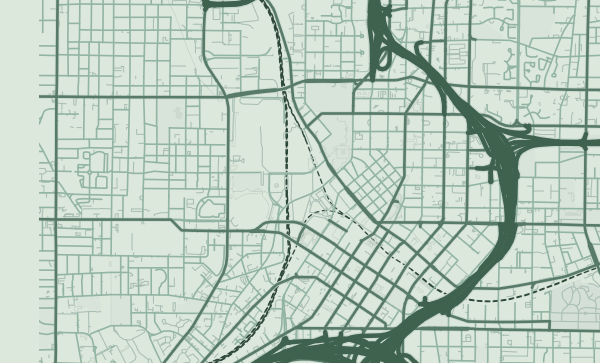
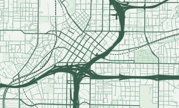
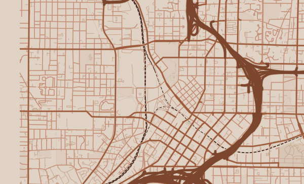
Atlanta's map tells the story of a railroad city that became a metropolis. The original rail junction at the heart of downtown created a street pattern that's neither grid nor radial but something uniquely its own — streets meeting at odd angles, viaducts crossing over rail yards, and Peachtree Street winding northward along a ridge in defiance of anyone who expects a main street to be straight. The tree canopy that gives Atlanta its nickname — the City in a Forest — is visible on any map as an extraordinary density of green interrupting the urban fabric.
Start with your location
Atlanta in every style
The same streets, completely different moods. Choose a look that matches your space.
Peachtree's Ridge Road
Peachtree Street is Atlanta's spine, but unlike most main streets it follows a ridge rather than a grid — winding, curving, occasionally surprising. On a map, its path from downtown through Midtown to Buckhead traces the city's topographic backbone. There are over 70 streets in Atlanta with "Peachtree" in the name, and on a map they branch off like tributaries of a river. The Sage theme captures Atlanta's green, rolling character — a city built on hills and draped in trees.
The BeltLine Loop
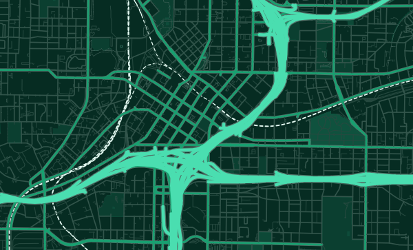
The Atlanta BeltLine — a 22-mile loop of trails, parks, and transit built on a former rail corridor — is one of the most significant new features on the city's map. It encircles the urban core like a green necklace, connecting neighbourhoods that were previously isolated. On a poster, it reads as a perfect ring, connecting Piedmont Park to the Westside to Grant Park. The Emerald City theme makes this green loop the centrepiece of the map.
Claim Your Atlanta Neighbourhood
Virginia-Highland's walkable village grid. Decatur's town-square charm. West End's historic blocks. Inman Park's curving Victorian streets — Atlanta's first planned suburb. Whether you're ITP or OTP, your Atlanta has a distinct shape on the map. Zoom in and frame it — because nobody's Atlanta looks like anybody else's.
Neighborhoods
Jump straight into an iconic Atlanta neighborhood and start designing.
Gift ideas
Make it personal for the moments that matter.

Questions
Answers about customizing and ordering a Atlanta map poster.
Can I customize an Atlanta map poster?
Yes. Choose the map crop, color theme, text, coordinates, labels, and print format before ordering.
Which parts of Atlanta can I map?
You can start with places like Midtown, Virginia-Highland, and Inman Park, or search for any address, landmark, or neighborhood.
What formats are available?
Digital downloads are available instantly. Fine art prints, framed posters, and canvas prints are available for US shipping where the selected size supports them.
Ready to create your Atlanta poster?
Choose your theme, zoom into your favorite street, and make it yours.
Start designing